SERVICES
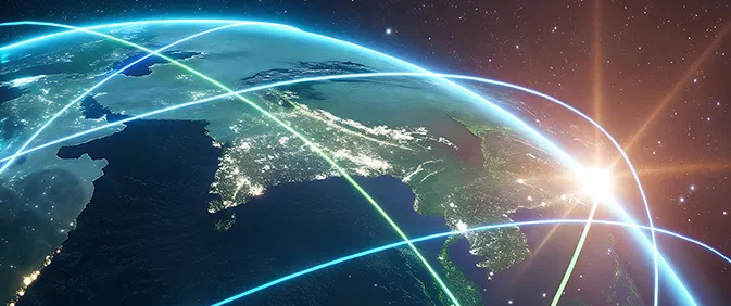
Star Signal Solutions develops and operates the core technologies required to solve the rapidly worsening space-traffic problem.
Our solutions cover the entire chain of space-situational awareness—from object detection to orbit prediction, database development, and collision-avoidance navigation.
Observation
We provide high-precision observation services using proprietary image-processing technologies capable of detecting faint and small objects—including debris under 10 cm—at high speed.
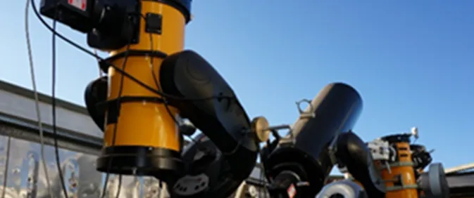
Our capabilities are supported by our own telescope systems and a dedicated observation network.
Orbit Analysis
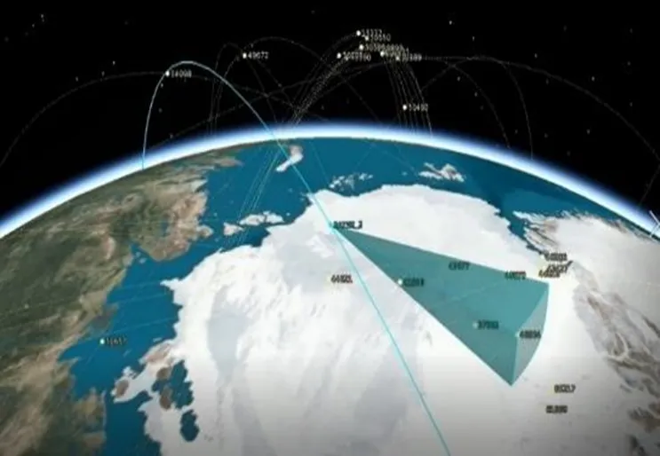
Our inhouse orbit-determination and prediction technologies enable highly accurate tracking of space objects and precise forecasting of their future trajectories.
This foundation supports safer satellite operations and longterm space environment management.
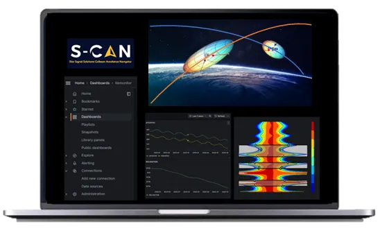
S-CAN
S-CAN, our Space Collision Avoidance Navigation service, is a sophisticated software solution designed to optimize satellite operations by enabling efficient and reliable avoidance of approaching objects. It also supports autonomous collision-avoidance maneuvers, enhancing the safety and resilience of spacecraft operations.
- MERITS
-
Enhancing operational safety while reducing the cost of collision-avoidance maneuvers
Our service improves the safety of satellite operations and significantly lowers operational expenses associated with executing collision-avoidance maneuvers. - STRENGTH
-
A robust system based on JAXA’s proven RABBIT tool
Commercialized from RABBIT, JAXA’s debris approach risk-assessment tool used for over 140 satellites across 60 organizations, S-CAN offers a highly reliable and operationally validated platform for avoiding conjunction risks. - FEATURES
-
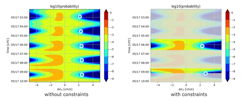
Collision Probability Calculation
This feature computes metrics such as collision probability, miss distance, and other parameters essential for planning collision-avoidance maneuvers.
Users can analyze Conjunction Data Messages (CDMs) and, based on their satellite’s operational constraints, determine the most appropriate maneuver plan.Recommended Maneuver Planning
Based on collision-probability calculations and the user satellite’s constraints, S-CAN generates several recommended avoidance plans.
Users simply select the most suitable option to carry out safe and efficient collision-avoidance operations.
By predefining priority criteria, users can even automate the final maneuver-decision process.Web API Availability
We provide a Web API that enables seamless integration of S-CAN’s functionalities into your existing systems, allowing for automated data processing and streamlined operational workflows.

Observation Service
Ensuring Space Safety Through Advanced Object Detection
To prevent collisions in space and protect the orbital environment, it is essential to conduct Space Situational Awareness (SSA)—the process of identifying and tracking the vast number of objects navigating through space.
Leveraging advanced image-analysis and processing technologies, our observation service enables the rapid detection of dark, small objects, including debris smaller than 10 centimeters.
- MERITS
-
Enabling Precise Orbit Determination and Status Monitoring for Satellites and Debris
Our service provides accurate orbit determination and condition assessment for satellites and space debris. This information can be directly leveraged to support satellite operations and enhance mission safety and reliability. - STRENGTH
-
Advanced Imaging Technology Enabling Detection of Dark Objects with Compact Telescopes and Onboard Cameras
Our proprietary image-analysis technology enables the detection of faint objects even with small ground-based telescopes or onboard cameras mounted on satellites.
In addition, we operate our own network of telescopes and observation stations, providing a highly reliable infrastructure for continuous and accurate monitoring. - FEATURE
-
High-precision Space Object Catalog Construction
By combining publicly available data with Star Signal Solutions’ proprietary space object observation data, we generate and provide a high-precision orbital catalog that includes debris smaller than 10 centimeters.
This enables more accurate risk assessment and supports safer, more informed satellite operations.